-
 Digi Maps™
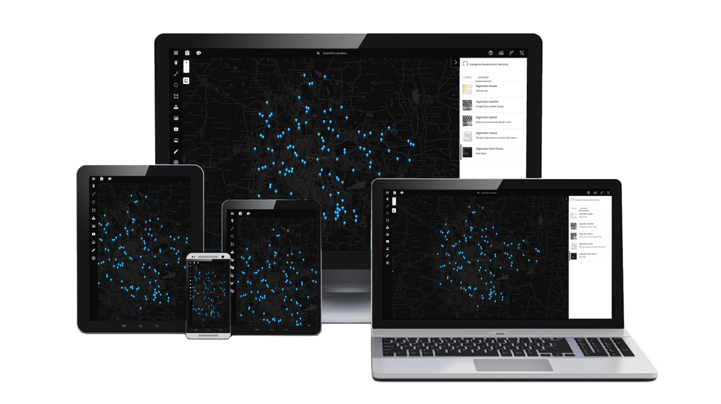
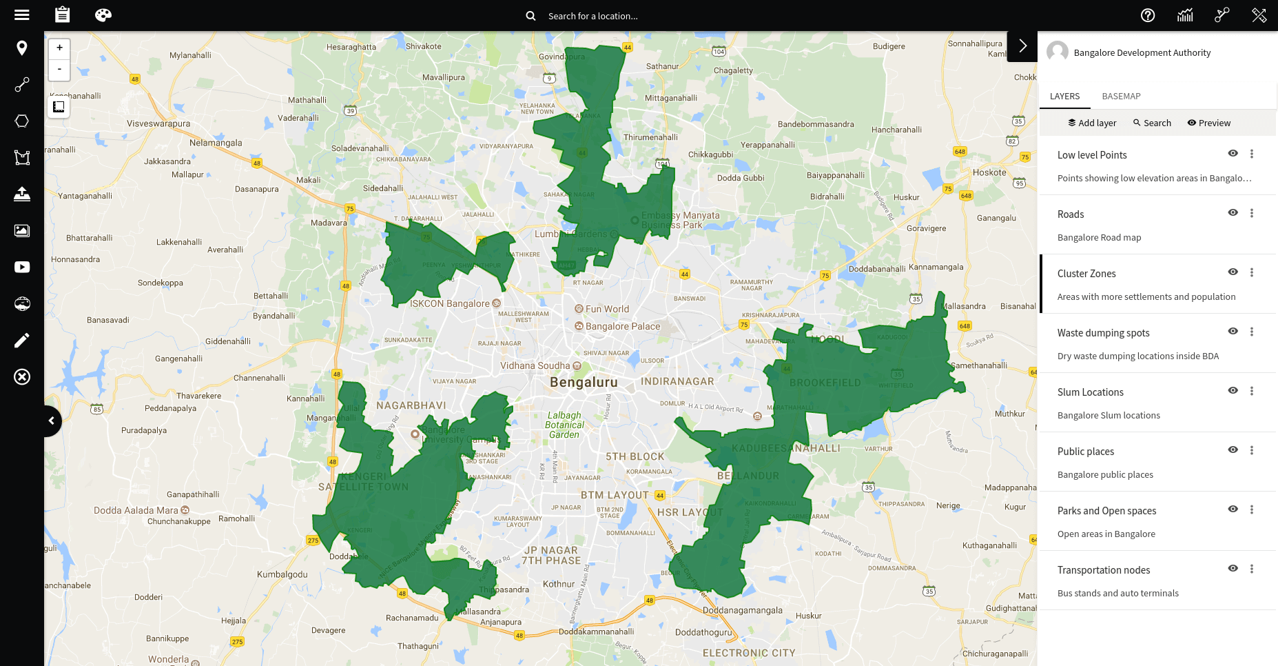
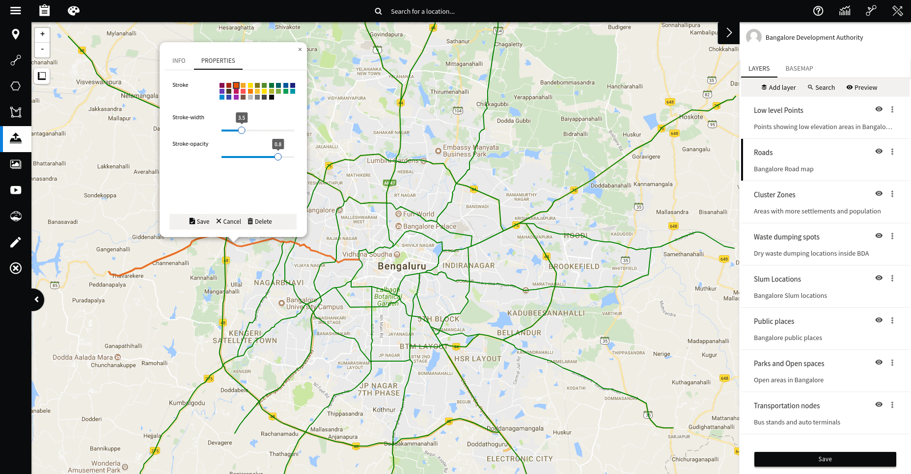
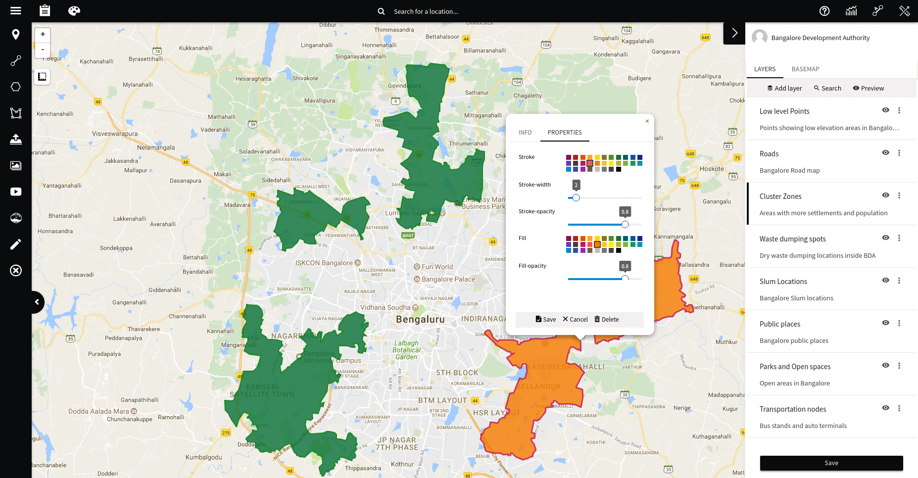
Mark multiple AOIs (Areas of Interest) on individual layers. Visualize all your layers on a google base map or a more detailed drone imagery.
Seamless integration of 2D photos and 3D photospheres from the mobile app to the cloud where you can visualize and manage them.
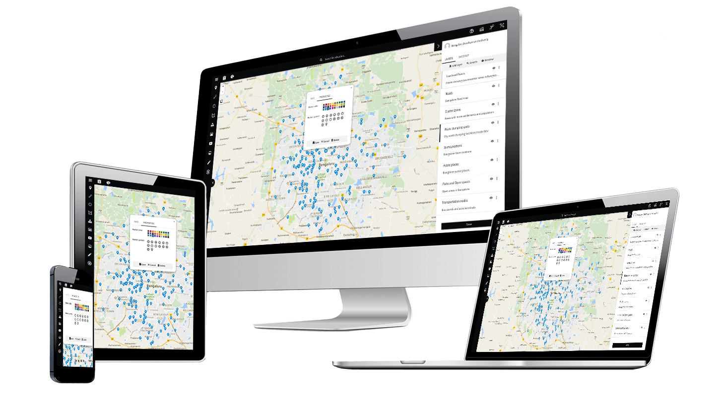
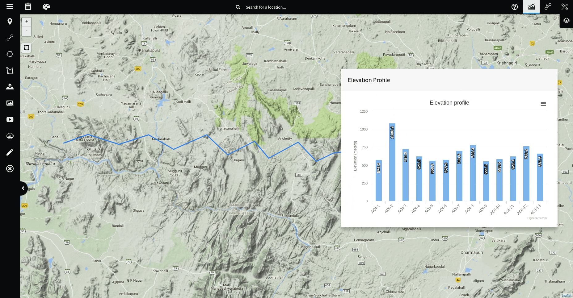
Measure distance, calculate area and view elevation profile. Point, Line and Polygon support for Layers. Search and locate AOIs(Areas of Interest) using filters.
Digi Maps™ is built keeping in mind the extensive visualization capabilities required for projects involving field based assets which are directly applicable to the construction , real estate , energy and infrastructure sectors.
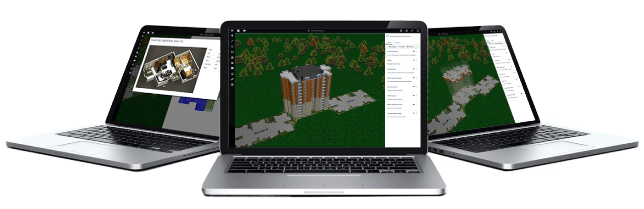
Directly visualized from your CAD drawings and rendered with true 3D running on your browser. We help you visualize extensive models from within our cloud based application.
Create and Visualize your Area of Interests (AOIs) using Points, Lines and Shapes on the map with Labels and automatic Legends and Search filters. Use DigiMaps projects on the marketplace for larger infrastructure projects. Enjoy seamless integration of field based photos and photospheres onto the platform and more..

Get depth beyond what Google Maps offers. We help you offer high resolution imagery for your assets. Visualize them better

Redefine the way of visualization through our app. Have a clear view of your assets in high resolution imagery. Visualise it better!

2D photos, 3D photospheres, Labels, Legends, AOIs marked at your locations, data, tools and tips visualized on razor sharp levels.
We help build the perfect solution for your business.
Contact us for help, additional info or assistance and we'll be with you in no time!